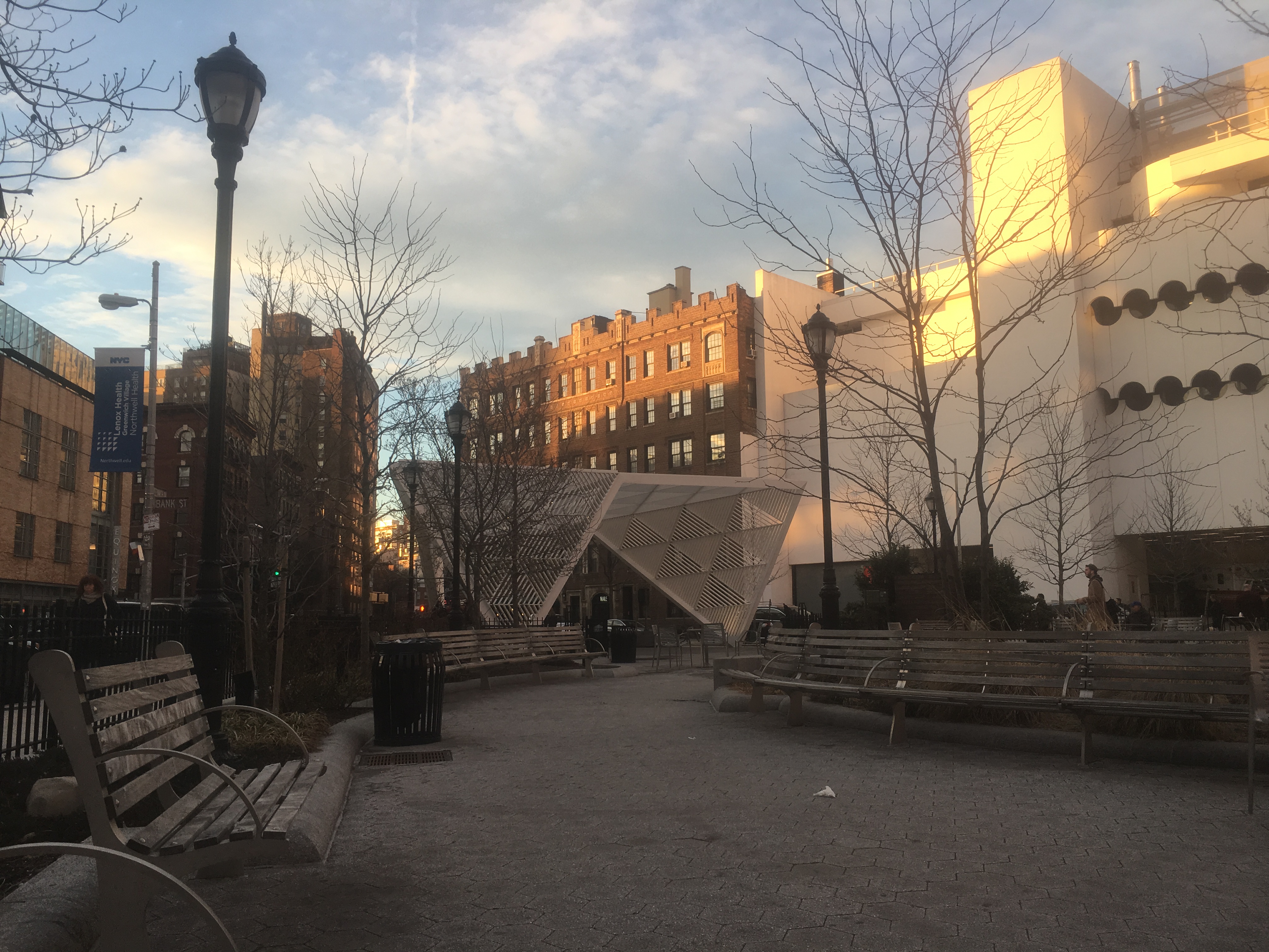
Deconstructing St. Vincent’s Triangle Park (NYC AIDS Memorial)
The park lies within the crossroads of Greenwich Ave, 7th Ave, and 12th street, forming a triangular pocket that serves as an escape from the streets. Upon entering the park, the area’s ambiance changes. A grass core surrounded by benches and tables welcome the visitor to take their time to socialize and take a moment to appreciate their position in space and time in the overwhelming New York City.
I studied two distinctly different times of the day: busy weeknights and the soothing daytime. The two times of day have drastically different feels, but the foundation of the park of course remained.
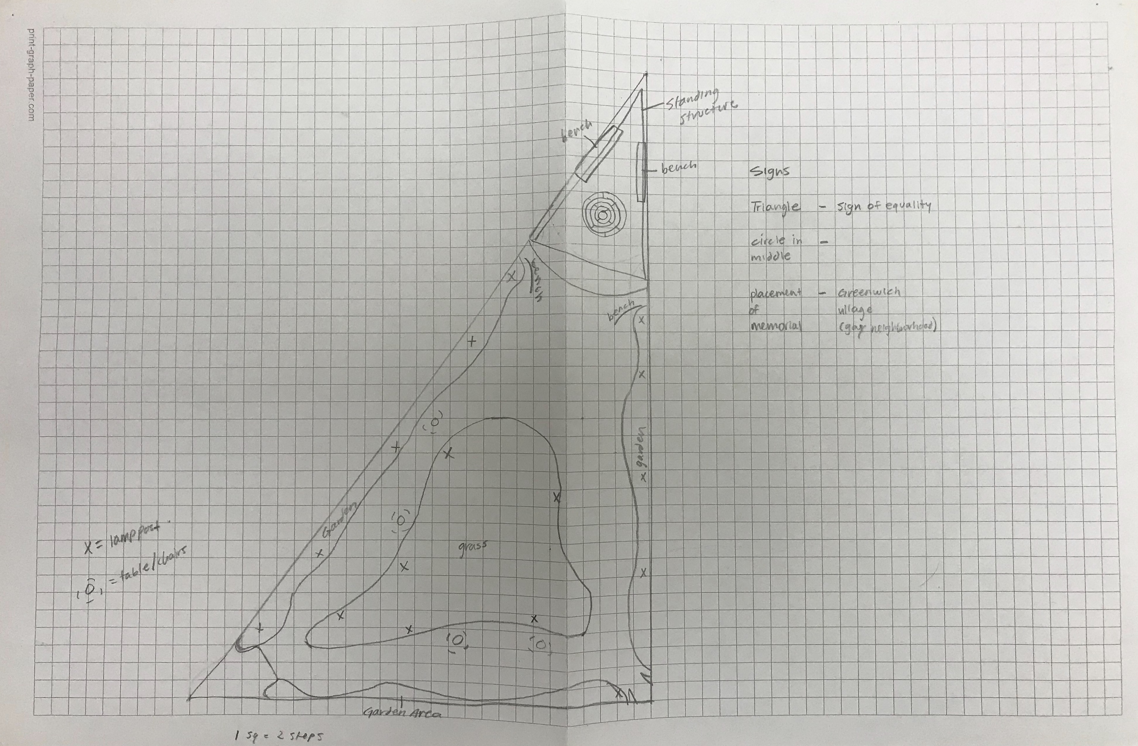
Below is a two-section topographic map:

The park consists of two sections: the general sitting space and lawn and the AIDS Memorial on the far corner. I studied the sounds, attendees, and other surroundings to construct visual maps.
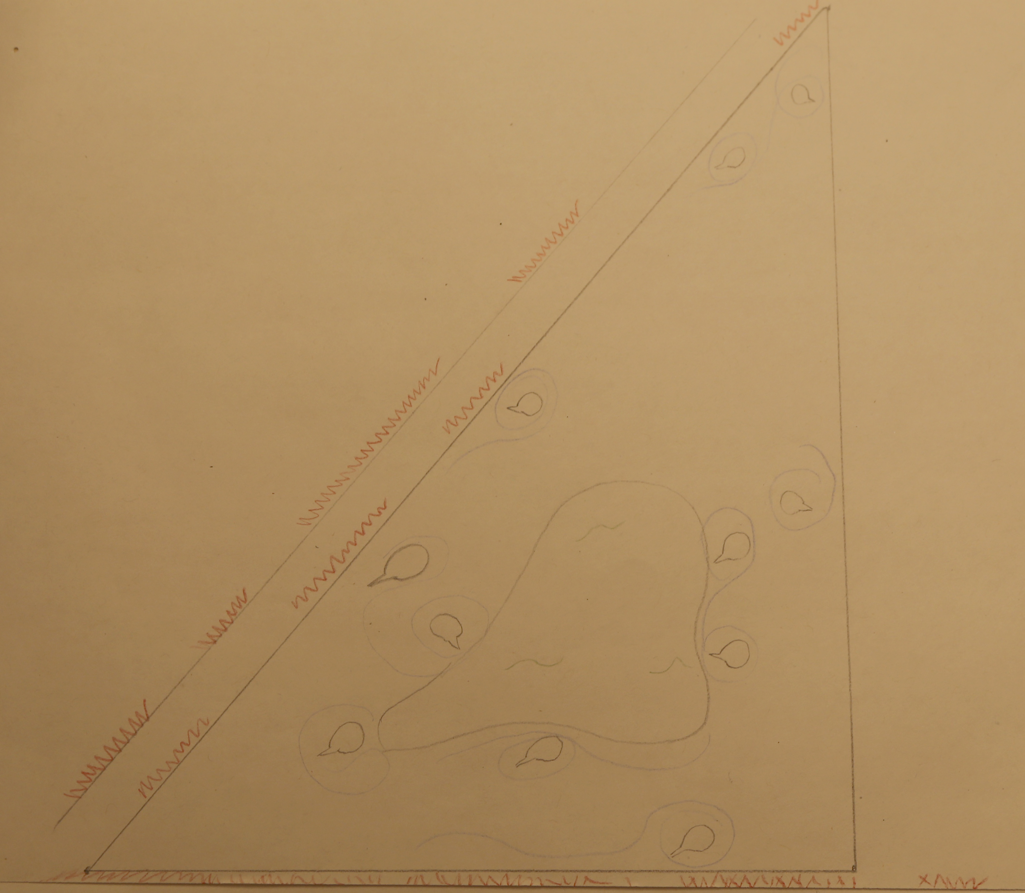
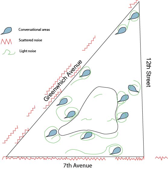
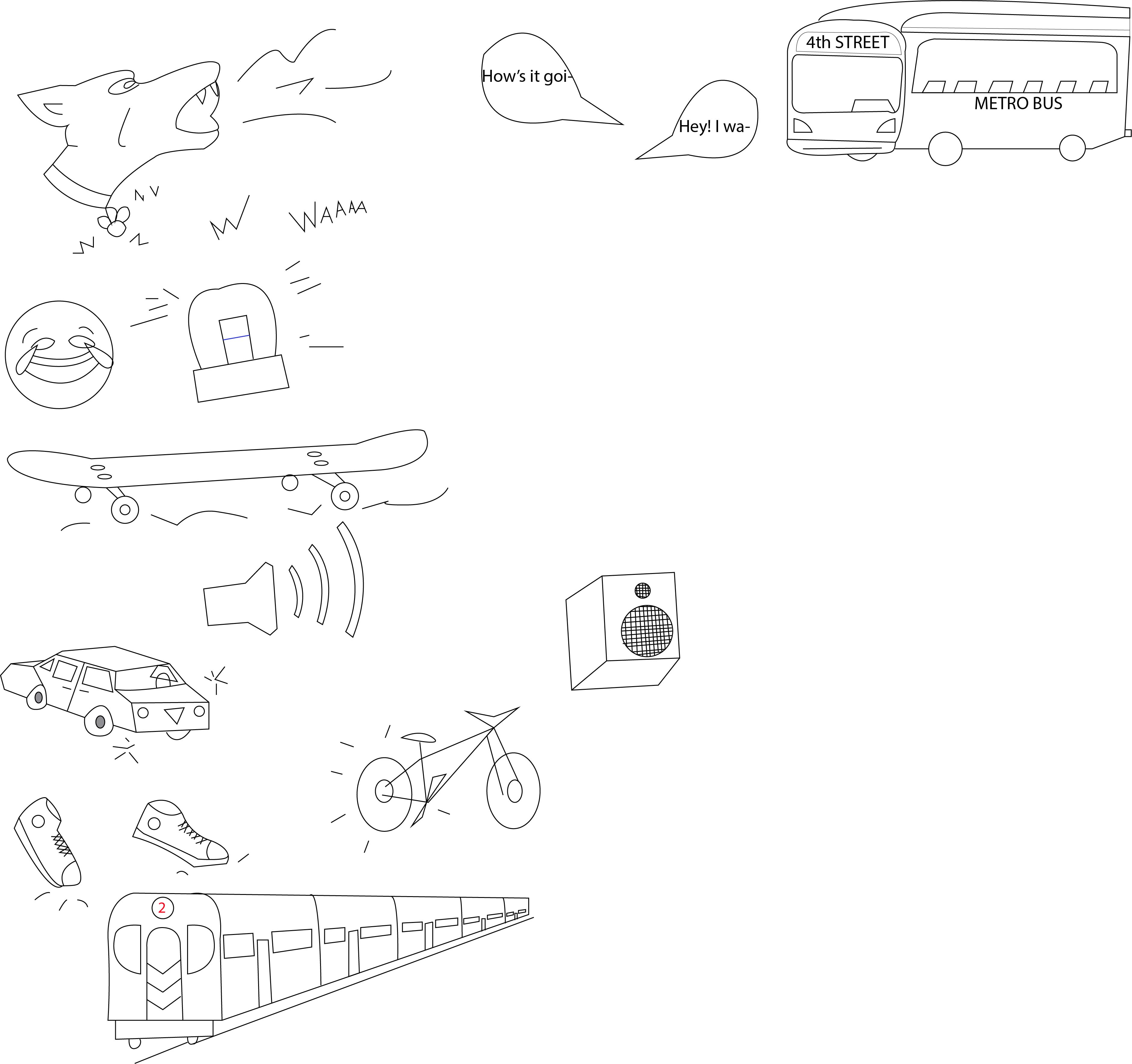
The map above shows the areas and types of sounds engaging with the park. The red jagged lines represent the busier noises coming from outside of the park from the nearby restaurants and streets. The smoother and spiraling blue lines represent conversational areas that are quieter and natural.
I measured some key features of the park in relation to my body. Below are some of my findings:
I studied the different textures within the park and recorded them through rubbings. I also made a color palette to determine the flavor of the park which I found was soothing and earthy.


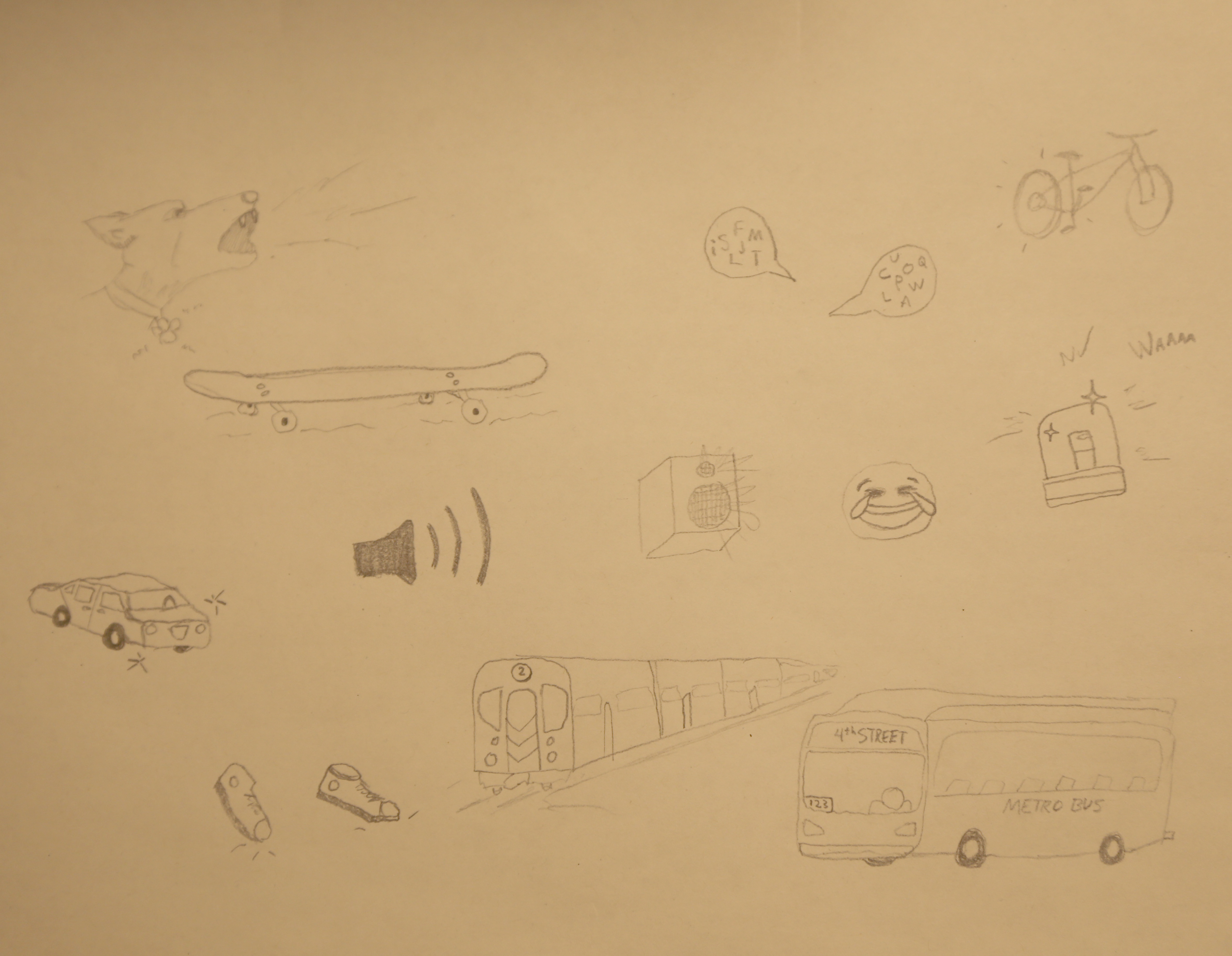
While observing a Wednesday night at 7 pm, I heard dogs barking, cars, bikes, and skateboards passing, conversations, footsteps, busses, sirens, a bag of chips crinkling, laughter and coughing all around me. There were at least thirty other people in the park, and many more surrounding it.
While observing the park on a monday afternoon, I heard similar noises. Busses, distant talking, car horns, brake screeches, footsteps, collars jingling, kids yelling, and an ambulance engine running awaiting a call. As I sat in a different part of the park than before, I could hear and feel the subway running below me. The ground rumbled as I heard faint screeching of its wheels. There were much less people in attendance, approximately eleven people and two dogs.
I made a map that breaks down each area of the park. Some of the areas include the best places for certain activities. I have labeled them below:


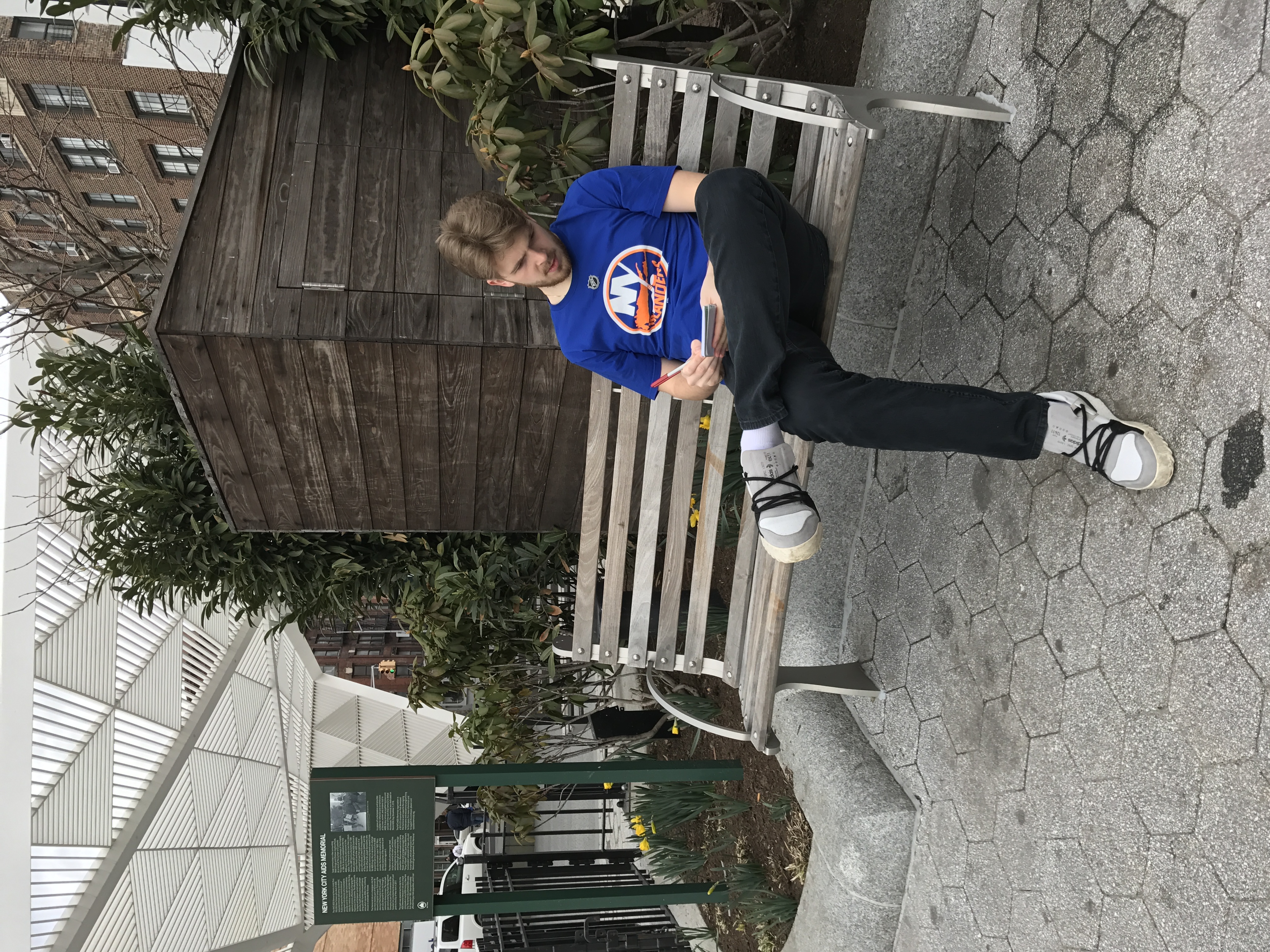
To document how I and most users use the park’s space, I photographed myself sitting at a bench.
I also photographed details of materials and features within the park to capture the textures and elements that constitute the space.