Ahmrii Johnson
15 November 2018
Battery Park and Red Hook Waterfront
Sustainability Practices at Battery Park –
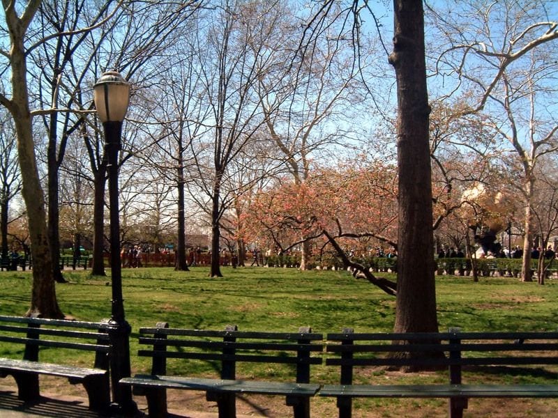
The Battery Conservancy has made efforts to move forward with capital projects, aiming to be a model of preparedness, incorporating new strategies for resiliency in New York’s oldest waterfront park. the group has commissioned a horticultural plan for extensive gardens, by selecting salt-tolerant perennial plants and grasses. Acres of concrete have been replaced with porous gravel and toxin-free lawns, reducing runoff and providing natural cooling. All structures are built to the 100-year flood levels and a half-acre of native plants were planted in the edible forest farm. Post-Sandy, only native trees have been planted, which were the survivors. In addition, the standard-setting Playscape, which is completing design, will include granite hills and sand dunes to manage rain and flooding along with natural berms for active play. With high-volume visitorship in mind, the organization planted the lawns with Kentucky Bluegrass, overseeded with a blend of tall turf type fescues and add clover. The Battery Conservancy puts emphasis on the recognition of the critical role nitrogen producing clover plays in soil health. Clover is a legume, and legumes pull nitrogen from the air around them and store it in nodules on their roots. These capsules of nitrogen eventually break off, mix in with the soil, and get absorbed by other plants. Clover provides nutrients for the grass naturally, so the Conservancy need not use the harmful synthetic fertilizers.

The Big U’s Proposal for Manhattan Beginning at Battery Park –
Rebuild by Design, an initiative of the Hurricane Sandy Rebuilding Task Force and HUD, addressed structural and environmental vulnerabilities that Hurricane Sandy exposed in communities throughout the region and developing fundable solutions to protect residents from future climate events. BIG Team’s Big U is a vision for a protective system around Manhattan from West 54th street south to The Battery and up to East 40th street: 10 continuous miles of low-lying geography that comprise an incredibly dense, vibrant, and vulnerable urban area. The proposal was conceived as 10 continuous miles of protection tailored to respond to individual neighborhood typology as well as community-desired amenities. The proposal breaks the area into compartments: East River Park; Two Bridges and Chinatown; and Brooklyn Bridge to The Battery. Like the hull of a ship, each can provide a flood-protection zone, providing separate opportunities for integrated social and community planning processes for each. Each compartment comprises a physically separate flood-protection zone, isolated from flooding in the other zones, but each equally a field for integrated social and community planning. The compartments work in concert to protect and enhance the city, but each compartment’s proposal is designed to stand on its own.The section of the Battery weaves an elevated path with a series of upland knolls to form unique landscapes. The plan envisions transforming the existing Coast Guard building into a new maritime museum or environmental education facility featuring a “Reverse Aquarium” where visitors can observe tidal variations and sea level rise.
 Red Hook Waterfront –
In the middle and late 20th Century, the New York waterfront and the city as a whole experienced significant deindustrialization. The once productive shores of Lower Manhattan and Northern Brooklyn were rendered obsolete by a need for more space and by modern technology such as the standard shipping container. New York experienced a serious identity crisis; once the most productive port in the world, the city’s development subsequently pointed inward and shifted its focus from blue collar to white-collar work. Although sea level rise and
climate change were not yet a major concern, serious doubt was cast over the waterfront’s future. The waterfront in New York slipped into a period of dereliction; crime and vice ran rampant in the shadows of abandoned factories and machinery that had formed the backbone of the city’s economy for centuries. Fortunately, the area has progressed in this modern age despite challenges from natural disasters. Although Hurricane Sandy was an incredible tragedy, it also represents an important opportunity to change and protect New York and its waterfront for the future especially in the context of contemporary growth along the shore.

Red Hook Waterfront –
While the commercial prowess of Manhattan was in decline by the end of the 19th Century, Brooklyn was rising. Just like in Manhattan, widespread landfill and pier construction completely changed the landscape of the Brooklyn shoreline in the interest of fostering
commercial activity. Bone comments that landfill added “literally hundreds of acres of port related facilities to Brooklyn that included enormous basins, dry docks, storage warehouses and thousands of feet of piers”(Bone 2003, 167). The Brooklyn waterfront from the Newtown Creek to Sunset Park was extremely productive during the first half of the 20th Century following the incorporation of the City of New York in 1898. One of the most productive periods for the waterfront was the years the United States was involved in World War II. The Brooklyn Navy Yard employed nearly 100,000 men and women who were responsible for the construction of a large portion of the Naval fleet employed during the conflict. The post World War II period was however not nearly as productive for the Navy Yard and the waterfront of the city as whole. Indeed the waterfront as a commercial entity was quickly shrinking towards the point of obscurity, an unfathomable prospect considering its productivity just a decade before. However the straw that broke the camel’s back was the advent of the modern shipping container. This technological advancement in shipping quickly became an industry standard, rendering the piers,
warehouses and wharves of the New York waterfront obsolete.
 Red Hook Waterfront –
According to the new York City College of Technology, while the Brooklyn waterfront holds much in common with other coastal regions—and with those of its sister boroughs— the challenges it faces are unique. The past two decades have ushered in a dramatic transformation of the Brooklyn waterfront district’s built environment. Now, it is faced with yet an additional dramatic waterfront transformation in the coming two decades, one the will be driven by the unwieldy forces of ecological systems. The issues of sea level rise, subsidence, and storm surges have already catalyzed change along the water—in the waterfront’s infrastructure, its transportation systems, its low-lying communities, and its public housing. What is the future of Brooklyn’s waterfront then? Various waterfront community leaders have shared possible solutions such as grassroots planning efforts, city officials’ near and long-term promises of resiliency planning, and architects will debate the role and limits of design in creating resilient neighborhoods. Environmental experts will discuss efforts to protect Brooklyn’s natural and constructed shorelines, including Jamaica Bay and Brooklyn Bridge Park.
The Strategic location of Battery Park –
The area’s strategic location was recognized by Native Americans and Dutch settlers, who called it Capske Hook (from Kapsee, an Indian term for rocky ledge). Near this point, the colonists of the Dutch West India Company began the settlement of New Amsterdam in 1625. As the colony grew and its commerce expanded, piers, wharves, and slips rose along the coastline. The Dutch constructed Fort Amsterdam as early as 1626, and around 1683, the first of a series of gun batteries was constructed around the shore. Its development as a public park owes to its enlargement through landfill. Fort George (as Fort Amsterdam was then known) was completely razed in 1788, and its remnants were used to fill in the shore and expand the Battery. Between 1808 and 1811, a new circular fort known as the West Battery was erected 200 feet offshore. It was renamed Castle Clinton (for Governor DeWitt Clinton) in 1815 and ceded to the City in 1823. Around this time, the park was extended further by landfills to an area of about ten acres. Another massive landfill project got underway in 1853 and was completed in 1872.