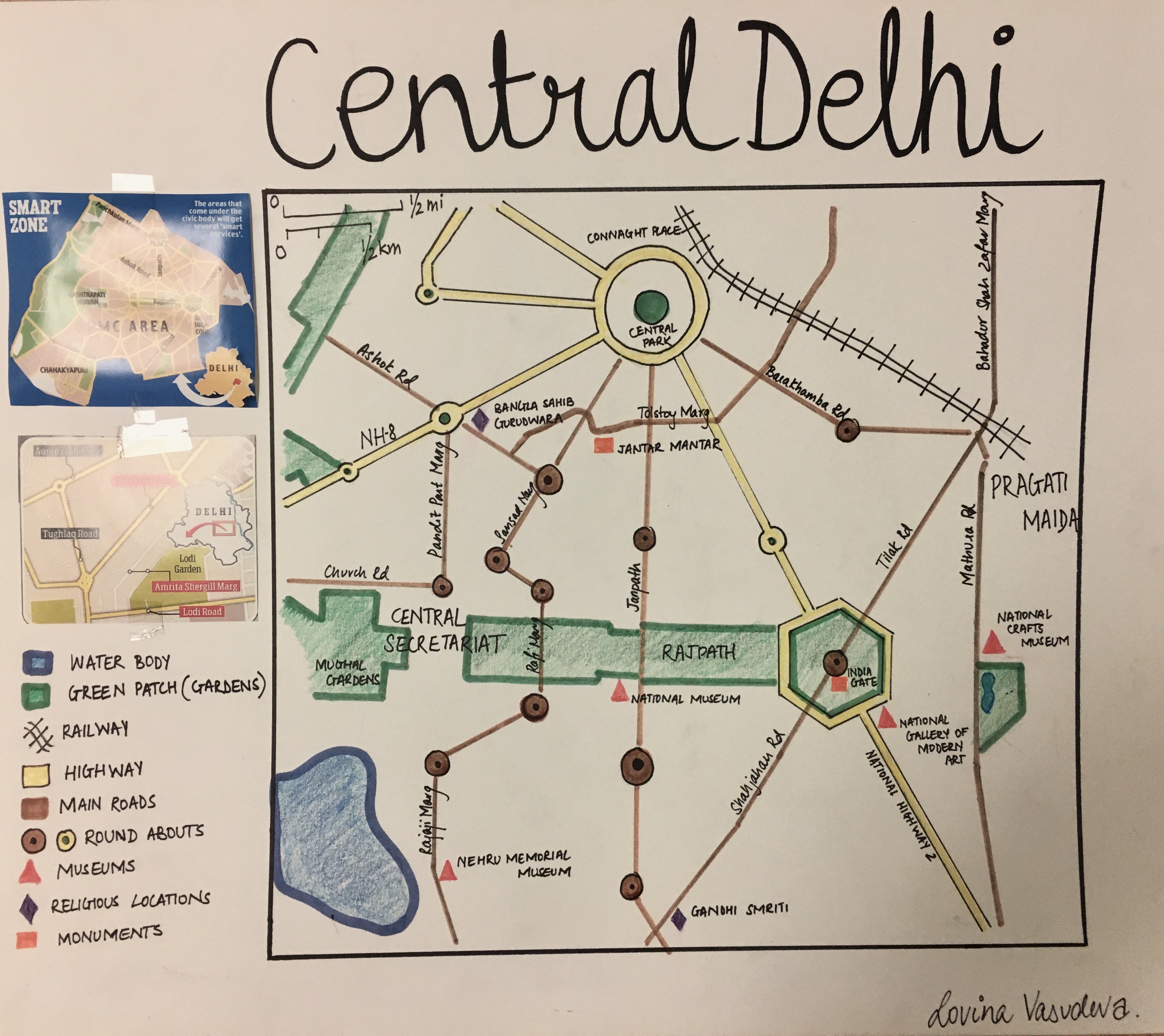
For this assignment we were supposed to simplify a map of our own town by minusing the secondary streets and adding shapes to replaces parks lakes etc. I used symbols to represent museums and monuments as well as colour coded the highway in contrast to the main roads. I chose to only keep the iconic tourist attractions, larger green patches and water bodies such as lakes and ponds. For the sake of navigation, I prioritised the roads that as most used and removed the residential streets that have bungalows and apartment buildings.
Through this visual activity I learnt that a map too has multiple unnecessary details that need to be shown, however they aren’t essential. Transforming a complex map into a more abstract and geometric layout is easier to understand at one glance. It holds all the information without overwhelming the viewer. Categorising types of infrastructure through a key, makes the task of reading a map even easier.