Our final vocabulary word for this semester is urban resiliency. How would you define this term for a friend? What is an example they would understand? How important is the concept of resiliency to you as an artist/designer? How might it help you creatively live and work in relation to the realities of climate change? Do you have any questions about our semester vocabulary?
I will define this word as the ability of a system and community in a cities, that will help the city to survive from different impacts. For example, how Japanese people dealing with the earthquake issues. I think is pretty important the keep in mind the idea of resiliency, because designer’s design can actually benefit human culture, for example, the one of the Parsons fashion major student designed a collection for homeless people, that the garment are waterproof, also can turn into a tent, and these garments were made by nylon, so it’s easy to pack and carry around. This is a great example of resiliency, this design helps people when they somehow effected by different circumstances.
Record this zone in your sketch book along with notes about what it feels like to learn what zone you inhabit. How close is the next, nearest zone to your home?
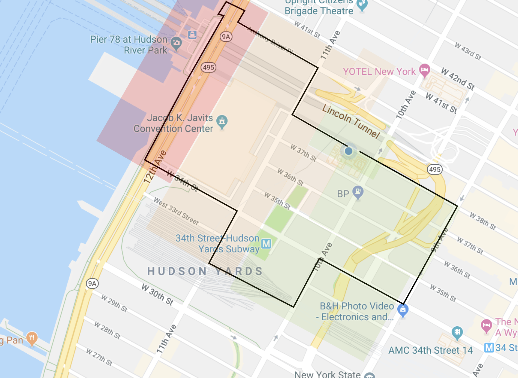
My home is located in zone 6, I went to zone1, zone 2 and zone 5. The closest zone will probably will be zone 2, I crossed two blocks and arrived at zone 2 which located at 38th St and 11 Ave.
Which zone is Parsons located within? Do you feel prepared for a hurricane in NYC? What are your thoughts on this website’s design (is it functional, aesthetic, easy to use etc.)?
Parsons is located in zone 6 (2W13th St). I do feel prepared for a hurricane here in New York, specially indoors. As the website, I think the design was every thoughtful, first visitors can easily see fine where the safe zone near them, for example where zone 6 and zone 5 are located, also visitors can select different languages, so when hurricane come, foreign visitors can easily find the safe zone as well.
Take photos, record audio/video and/or make responsive drawings of what you experience. Take a photo in each zone (min. 3 photos) and post them on your LP.

zone one zone two

zone six
3) Create a map of your route and upload to your LP post 4) Answer the following questions on your LP:
- Does an awareness of evacuation zones change the way you experience the city? – What areas appear to be vulnerable to storm surge, if any?
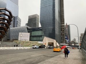
I think the zone one area between High line and Hudson yard seems to be vulnerable to the storm. Since this is in-between zone one and zone two, and aren’t any protection against the storm, especially there are train stations under the bridge, and people placed many broken trunks next to the High line entrance.
- Which zone do you live in? Do you feel prepared for a hurricane in NYC? What would make you feel more prepared?
I live in zone 6, but somehow I do not feel prepared for a hurricane, because my building is right next to zone one and zone two, the wind are insane, and I literally hear the wind are blowing every night, it’s even worst in the winter, and there aren’t any tall buildings in front my building, so that make me feel quite unsafe.
- Do any buildings/infrastructures look more prepared for the next storm — how? – Are any effects of Hurricane Sandy visible?
Zone 1: The riverside near 11 ave and 40th street, aren’t any tall buildings in this area, because of its right next to the Hudson River. There are many planted trees and plants on the riverside, that probably the first thing will be destroyed when the hurricane lands. Also, there are few Citi bike stations, and some ships were docked at the dock, and I think they will also be affected by the storm. In low-light or driving rain, probably will be quite hard to see the pedestrians, there are many crossing wild walks around this area.
5) Choose one zone (1-6) as your focus. What is a design idea you have that could communicate to the public what zone they inhabit? What kind of tool, device or signage would you make? Include a list of 3-5 challenges you would face in implementing this project in NYC (think about resiliency of materials, language issues, access to information, visibility during different times of day/during storms, diversity of publics etc.).
I’ll focus on zone one, since zone one will effect by the hurricane the most. First I’ll definitely build underground shelters, and set up emergency contact devices in there, also provide food, water and signal guns. And for sure to make big signs around these shelters, these sign were powered by solar energy, so no matter. In many conditions, people can easily have their attentions on the signs. so people will know this area can easily being effect by hurricanes, and if they don’t enough time to make it to the safe zone, but they have backups.
Some challenges this project might face.
-foreign visitors can not read the sign
– how to find the best way for people to find. The shelters when the hurricane arrives.