A thing I mentioned from my walks from last week was that there were multiple medical buildings in Lennox Hill.
For studio, we were supposed to create a map of an area in our neighborhood. I decided to create my map based on a portion of the area I explored, specifically from 3rd to 1st Avenue and 73rd to 67th Street. After referring to google maps for a more accurate compilation of medical-related buildings, I started to make the map. I first created outlines of the buildings and streets, then I marked every medical-related building with a red cross symbol.
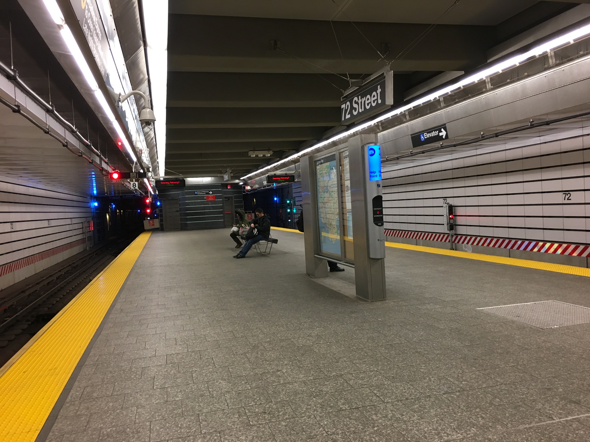
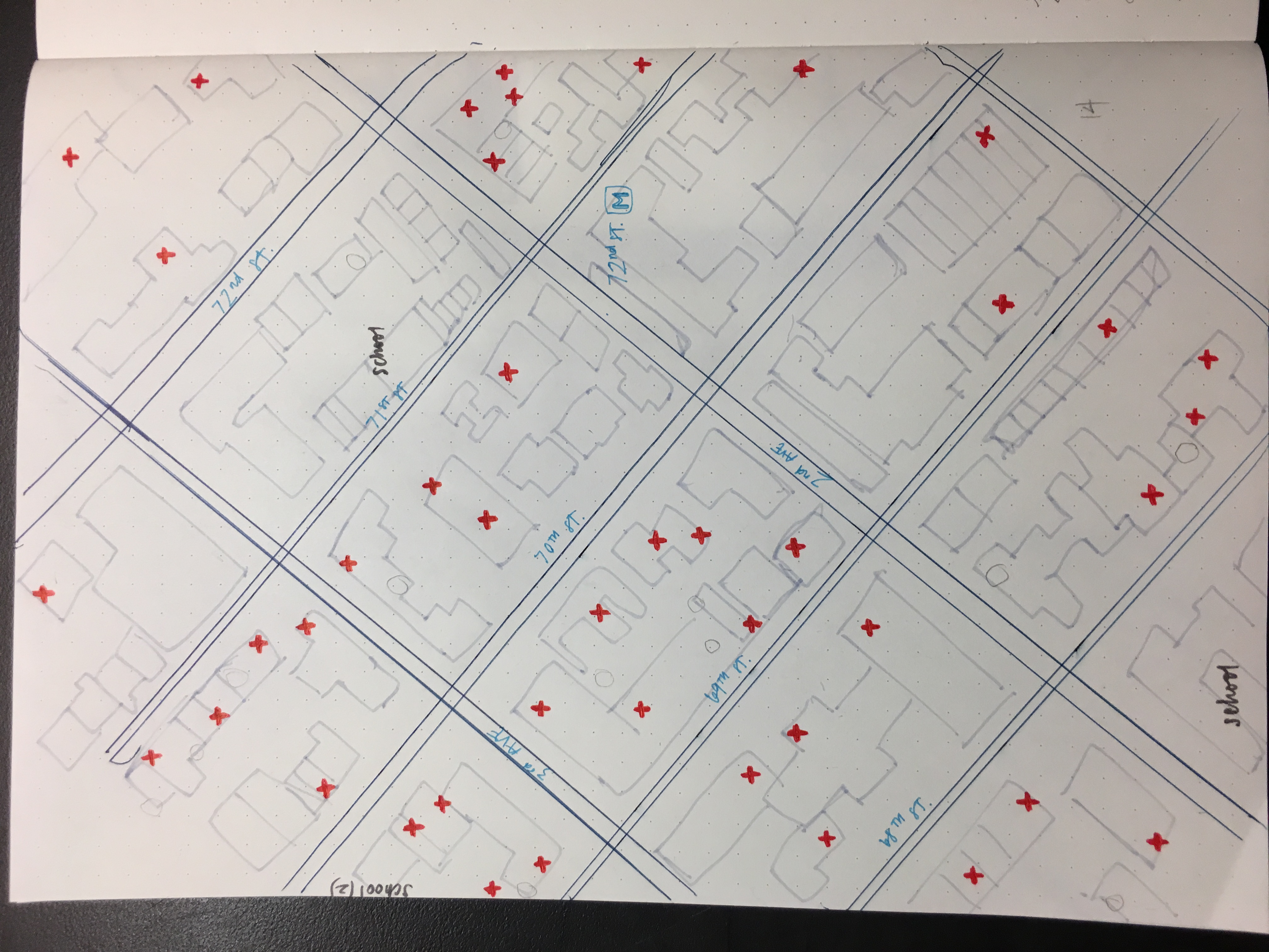 When referring to the map, the average number of medical buildings per block is about 4.2, and the most number in one block is 9. In total, there is 59 medical-related buildings within these 14 block. For the blocks with less of these buildings, I noted that there were schools in the block. Another case was, the 2 blocks near the 72nd Street subways station had little to no medical buildings surrounding it. This is logical because when I traveled to and from this station, it was obvious that a lot of money went into making it. There was a long escalator to get to the surface, and in general, everything was very spacious. I had never seen a subway station this big before, so I was relatively impressed. There was no presence of the normal crowdedness of people because it was such a big space. On the surface, I also noticed that there were more food places around this subway station rather than medical buildings.
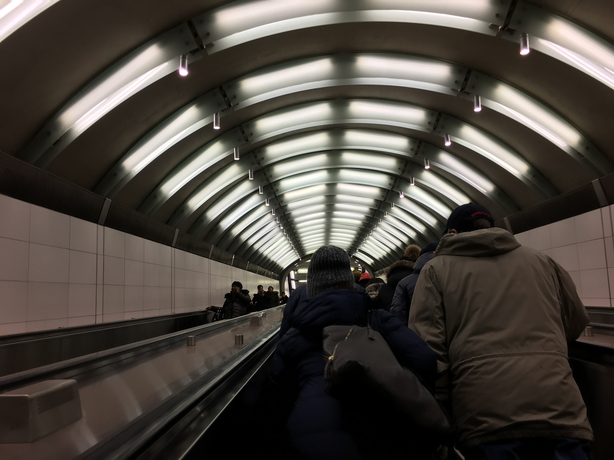
After doing some research, I learned that the idea of this station was proposed in 1919, and design for this subway station started in 1972. They even demolished the 2nd and 3rd avenue stations in preparation. There were 2 phases of construction, costing $431 million and $253 million respectively. In total, it cost about $700 million to fully construct. Given all this information, it is highly possible that they either restricted the types of buildings allowed in the surrounding area. This would allow for more food options near the station for travelers and commuters, giving more business and helping the surrounding economy.
Because of the incredible amount of medical-related buildings I saw, you could assume that the area had a relatively older-aged community. However, I was also observing the types of people I saw on my walks. Yes, there were many old people walking their dogs, but because there are also many schools in the area, I saw many children and parents with strollers. I also found that there were many bikes. Bikes were resting by every tree line and pole(I included a bike in one of my neighborhood sketches for studio). What was interesting was that there were large areas with citibikes to access, but no one was using them. The bikes were not seemingly expensive or new, it just seemed like everyone biked around with their own bikes.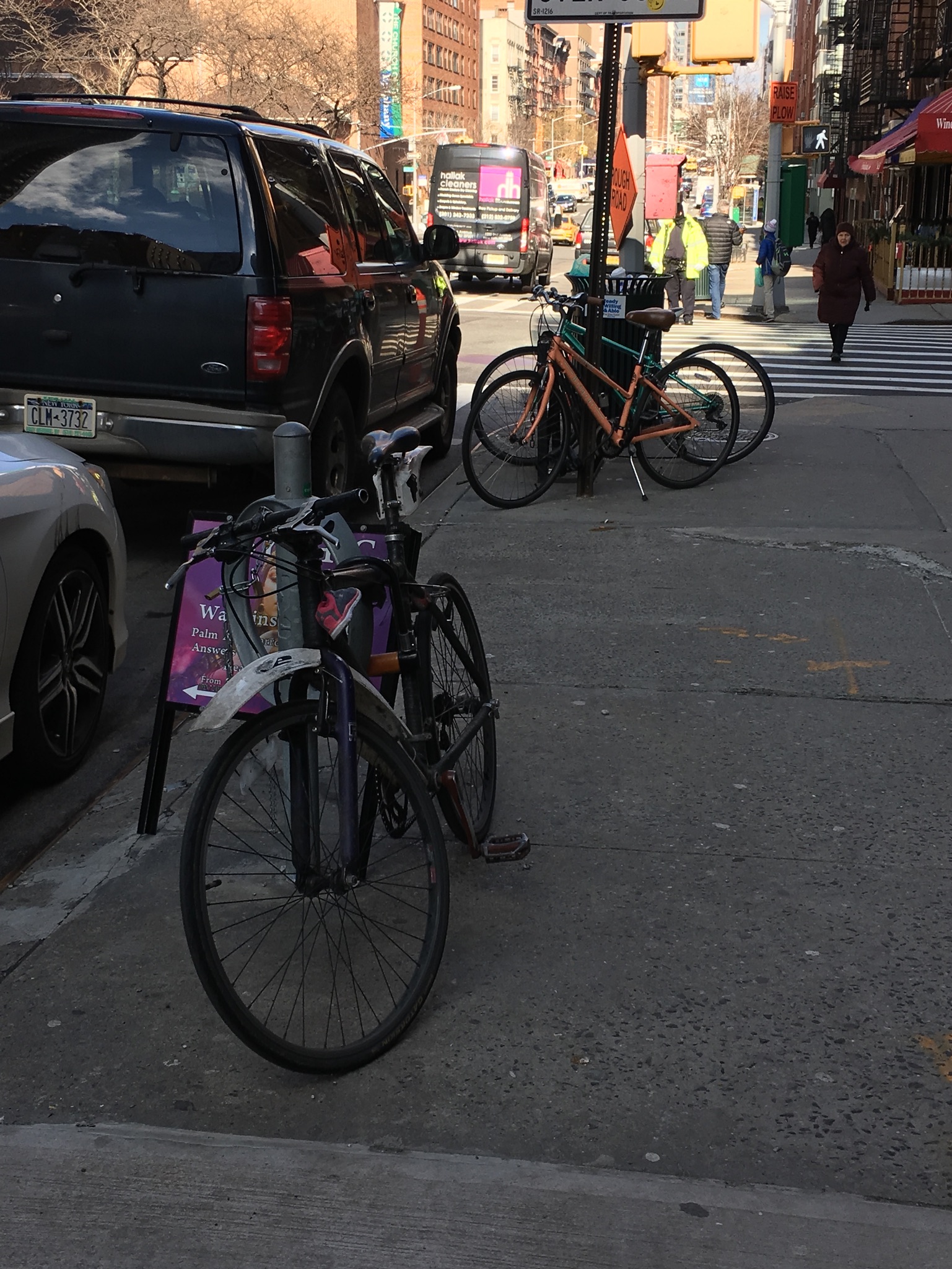
This could also be due to the fact that in every avenue, which had 4 lane wide streets, had an additional bike lane on each side, painted green. Or it could be likewise, the residents saw that there were big bike lanes, so they decided to invest in bikes.